Blog
Unlocking Landscape Intelligence for a Sustainable Future
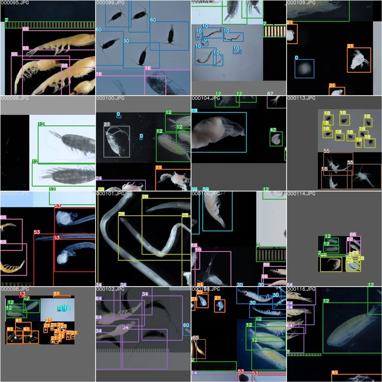
Plankton Taxation with Open-Source Computer Vision tools

Using Esri deep learning tools to map Hamilton City

Te Awa Kairangi/Hutt River in 360 video

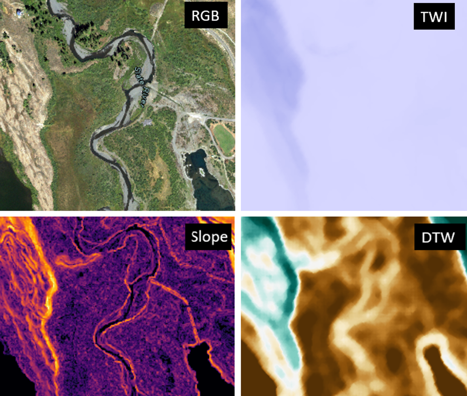
Technology integration for stream surveys
Multi band Deep learning

Using Stylegans to generate synthetic fish

Collecting aerial photography at scale for deep learning

Training Machine Learning models with ArcGIS Online

Rating Auckland suburbs for solar production

Reducing shadow impacts in Aerial Photography

72 Hours Part II: Fish Detection & Classification

72 Hours Part I: Fish Detection & Classification

Comparing roof top solar potential in New Zealand’s largest cities
It all begins with an idea.

NVIDIA announce next generation video cards
It all begins with an idea.

Embracing Serverless Geospatial
It all begins with an idea.

Automating land classification with machine learning
It all begins with an idea.