Lynker Analytics completes landmark project to map New Zealand’s buildings
Client: Land Information New Zealand
Lynker Analytics Ltd, in partnership with Toitū Te Whenua Land Information New Zealand, has successfully concluded a multi-year initiative to capture building outlines across Aotearoa New Zealand. Spanning over 3 million outlines, the project leveraged AI-driven image analysis to extract accurate 2D representations of buildings larger than 10 square metres from publicly owned aerial imagery.
Aerial Photography used for the project ranged in resolution from 0.075m to 0.30m, which required us to use multiple Machine Learning models. Higher-resolution areas provided clear rooftop details, while lower-resolution imagery, particularly in rural zones, often resulted in less precise detection. This variability, coupled with regional differences in roof colours, materials, and architectural styles, required us to fine-tune multiple machine learning models to ensure consistent performance.

Wellington Urban 0.075m (2021)
Otago Rural 0.3m (2020-2021)
Building outlines were extracted across varied regions, each presenting unique challenges. Wellington’s high-resolution imagery supported detailed extraction, while Napier required harmonisation of two distinct image sets. Waikato involved the use of draft imagery that would then be updated during the capture, prompting more manual adjustments. These variations required continual calibration to maintain national consistency.
The AI models produced pixel-based segmentation maps, which were then vectorised into polygons. Each polygon was scored against stringent quality assurance specifications, including geometric accuracy, shape complexity, and internal angles. While the goal was to minimise manual editing, a portion of the dataset required human refinement to meet the high standards set for national geospatial data. Including urban and rural areas within every region in the country, the team processed more than 220,000 square kilometres of aerial imagery between 2019 and 2024, resulting in the production of over 3 million building outlines.

Christchurch 0.075m (2023-2024)

Taranaki 0.1m (2022)
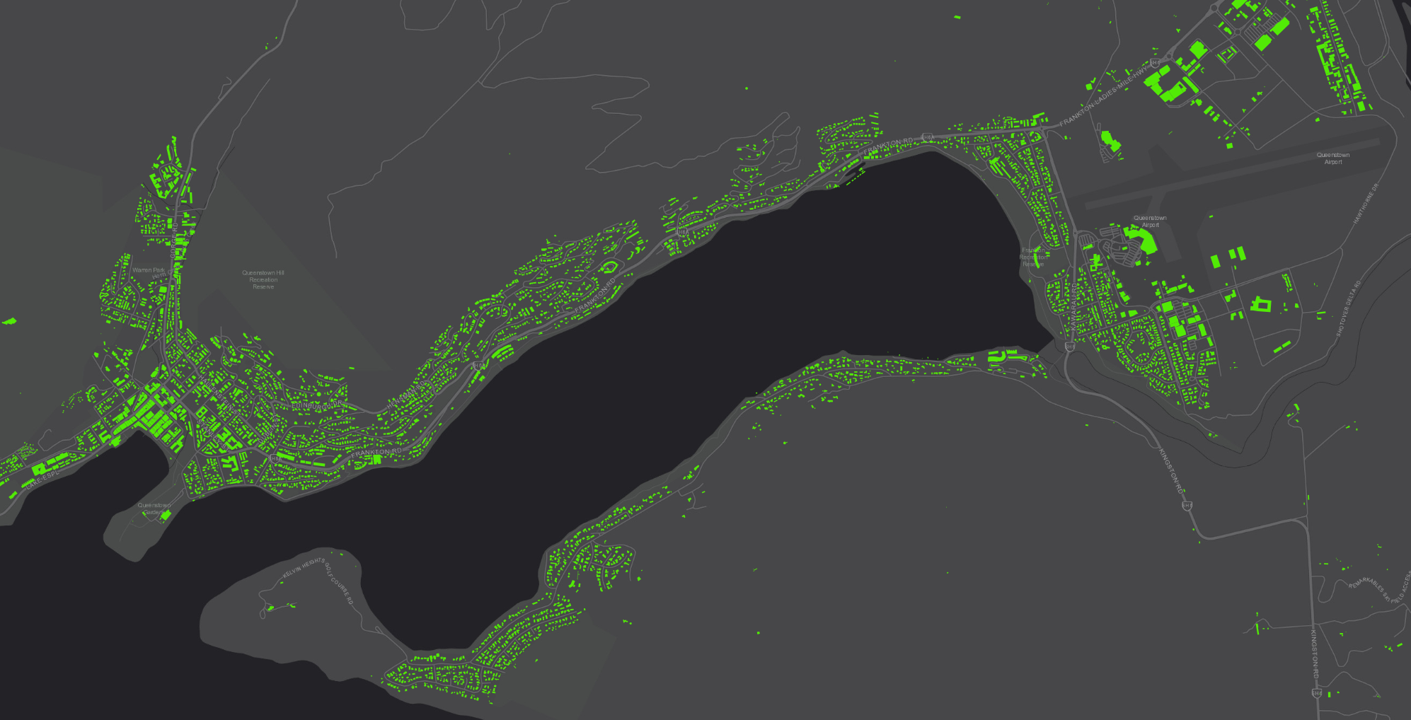
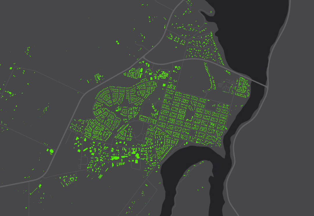
Queenstown 0.1m (2021)

Hawke’s Bay 0.25m (2023-2024)
These machine generated data sets contribute to a dynamic and highly accurate national dataset that will support a wide range of applications, including urban planning, emergency response, environmental monitoring, and risk modelling. This dataset represents a foundational layer of geospatial infrastructure that will benefit government agencies, researchers, and private sector stakeholders alike.
Lynker Analytics extends its gratitude to Topologic, our subcontractor who played a key role in completing the final three regions of the project. We also acknowledge the dedicated team at LINZ, whose collaboration and support were instrumental throughout the duration of this initiative.

Auckland 0.075m (2023-2024)
“This project marks a major milestone in New Zealand’s geospatial capabilities,” said Matt Lythe, Managing Director of Lynker Analytics. “We’re proud to have contributed to a dataset that will serve as a critical resource for years to come.”
Access the full dataset at: https://data.linz.govt.nz/layer/101290-nz-building-outlines/