Client: Auckland Council
For many years surveyors have measured heights in Auckland in metres above the Auckland Vertical Datum 1946 (AUK1946) which was established based on mean sea level in Auckland Harbour in 1946 and then extended across the city by leveling surveys along major roads. However this system is difficult to maintain and is susceptible to movement caused by earthquakes. It also means heights can be difficult to share between regions for national or inter-regional projects where other datums are in use.
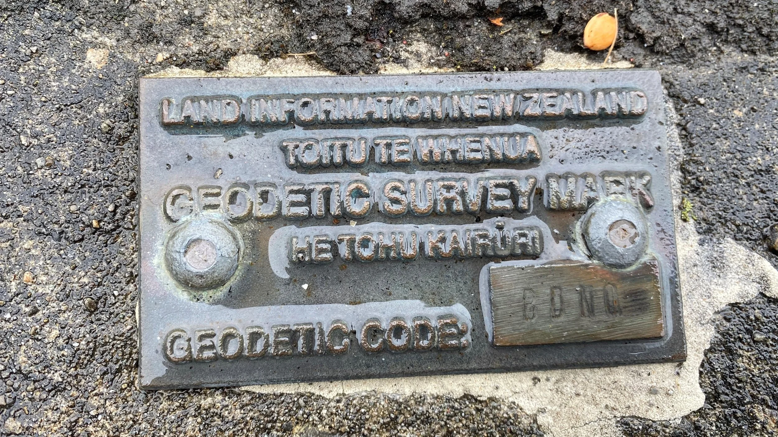
To resolve this, a new vertical datum, NZ Vertical Datum 2016 (NZVD2016) has been established as a standard for measuring elevation nationwide. NZVD2016 allows for the consistent collection and seamless exchange of heights across New Zealand. NZVD2016 approximates sea level which has risen about 20cm globally since 1946, accounting for most of the datum difference between elevations in AUK1946 and NZVD2016. Toitū Te Whenua Land Information New Zealand (LINZ) is now encouraging local government agencies to migrate their geospatial data to use NZVD2016.
To help prepare for this change Auckland Council contracted Lynker Analytics to provide an assessment of the impact of this transformation to their data and procedures and the programme of work required.
The project included the following activities:
Produce / Extract LiDAR datasets in the AUK1946 and NZVD2016: DEM, DSM, Contours.
Identify test areas based on expected conversion variation across the area.
Identify the datasets where there could be an impact of change.
Evaluate the impact of the new datum on all the reference datasets as outlined.
Evaluate the overall impacts of the change including positional and vertical change, topology and data utility e,g. impacts on flow direction, pipe gradients, as-builts.
In our analysis we reviewed more than fifty geospatial data sets grouped into 7 categories including elevation, assets, freshwater, coastal and marine, survey and other/misc. Impacts in a range of areas encompassing varied landforms, geology and land cover were then evaluated in detail.
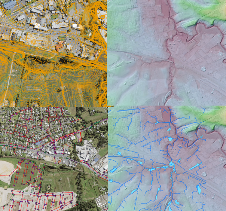
Analysis from Kumeu test area. 25cm topographic contours (top left), DEM (top right), overland flow and flood areas (bottom right), Asset data (bottom left).
Key findings include:
Most of the geospatial datasets that hold elevation attributes or are derived from elevation data sources can be safely and efficiently converted to NZVD2016 using standard GIS tools.
Conversion can be done in bulk including transforming all attributes in a single operation per layer, using the LINZ datum correction surface.
Overland Flow Paths (OLFP) show sensitivity to datum changes for lower order (smaller) watercourses.
Gradient changes in pipe assets, e.g. stormwater, as a result of the datum shift are minor.
The long-term spatial plan is future proofed for the datum change.
GIS metadata for elevation-related themes should be revised to clarify the vertical datum used for levels. Attributes for level data should be expressed in both AUK1946 and NZVD2016 datums for the foreseeable future.
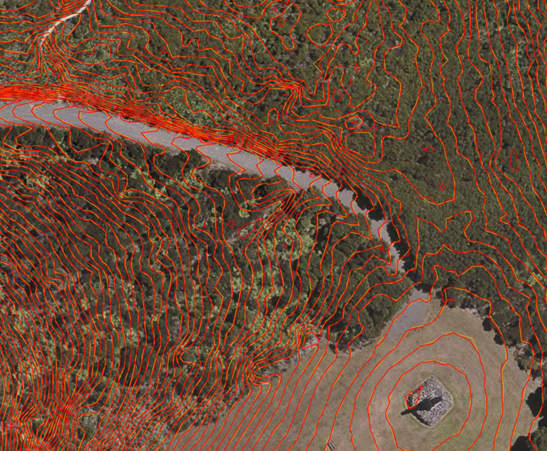
Spragg Monument, Kakamatua – contour comparison. The figure above shows Geomaps contours (orange) and contours from 2016-2018 DEM (red).
We also made the following recommendations to support the adoption plan:
Auckland Council require all as-built plans to clearly express the datum being used
Auckland Council migrate impacted GIS data using a standardised process.
Auckland Council transition to accepting as-builts using NZVD2016 immediately after Auckland Council’s GIS data are converted.
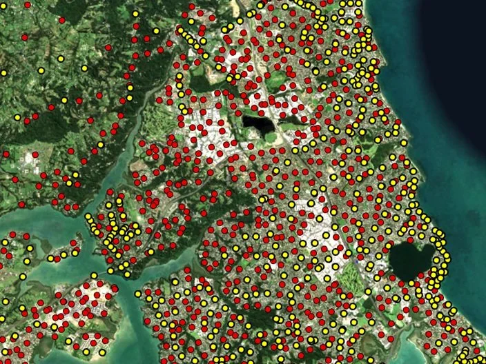
Geodetic marks in the Albany area. NZVD2016 (red), AUK1946 (yellow).
Generally there is a much higher and more even density of NZVD2016 marks especially in areas of urban development such as Albany shown here.
We also noted that as there is only a small (approx 30cm) difference between datums there is a risk of confusing data recorded in the two datums. This can be mitigated by ensuring the datum is expressed on all plans and in GIS metadata.
Deliverables:
Sample data and transformations
Technical report outlining the conversion impacts and the work programme required to undertake an Auckland-wide change.
Briefing of results and implications
This fact sheet from Toitū Te Whenua Land Information New Zealand (LINZ) provides more information on the new datum.